Friday, 5 August 2016

Malcolm Bluff - Hike 44

Headed north mid July on another beautiful day for a long single day hike. I arranged for a Wiarton taxi to follow me so I could park at the end of my hike and then drop me back at the beginning of my hike.

My 44th Bruce Trail section hike started at the 5.8km mark of the Peninsula section of the trail in Colpoy's Bay.

The trail headed east from Highway 9 through a farmer's fields coming out onto the escarpment around the 7km mark.


For the next 10km or so the trail headed north east along the top of the escarpment with incredible views out over Colpoy's Bay.

Much of this section of trail is contained in the Malcolm Bluff Shores Natural Reserve. The reserve covers approximately 1000 acres of escarpment, pristine lakeshore, wetlands and towering cliffs. In March 2011 the Bruce Trail Conservancy and Ontario Nature joined forces to acquire and preserve this area. There is about 110 meters of elevation gain from the shore at Colpoy's Bay to the highest spot on the escarpment resulting in stunning views!

Here are photos from this section.


A bench and small plaque dedicated to Sharon France who was an avid Bruce Trail hiker but passed away in 2009. The plaque says "We will finish her Trek Living each Day to the Fullest"!


Does anyone know what these small ground level plants are? They were popping up all along certain parts of the trail.


At the 17.1km mark, the trail entered the lands of the Nawash Band of Chippewa First Nations people. The reserve was established in the 19th century and is home to about 600 people. Here are some photos from this section of the trail.

First a warning sign and then a welcome sign!


A large chunk of escarpment rock perched precariously, looking like it could tip at any moment!


I finished up my hike at about the 21km mark as the trail crossed Coveney's Road where I had left my car.

Another incredible day of hiking!

Completed: 748.4km

Monday, 25 July 2016

Colpoy's Bay and Wiarton - Hike 43

I'm late getting this next hike logged but better late than never.

Early June, my older son and I headed north for a long single day hike. The weather was very nice - sunny and warm. We drove to Wiarton and parked the car there and got a local taxi ride out to our start for the day.

We started the day at the parking spot at the corner of Colpoy's Range Road and Gleason lake Road and hiked the 1.7km in on the Len Holley side trail to where it met the main trail at the 157.1km mark of the Sydenham section. The trail followed the brink of the escarpment through both wood and open areas for approximately 3km. At the 160.6km mark we took the access trail to the Bruce Caves. After about 0.5km we arrived at the caves - much more spectacular than I was expecting. The Bruce Caves are examples of caves that can be found all along the escarpment that were formed as a result of wave action of the post glacial Lake Algonquin 7000-8000 years ago. These caves are some of the largest along the escarpment. History recounts that Robert Bruce, a hermit, lived at the entrance to the caves in the 1800's. He would charge tourists, who arrived by horse and buggy, admission to enter and see the caves. Here are some photos of this section and the caves.


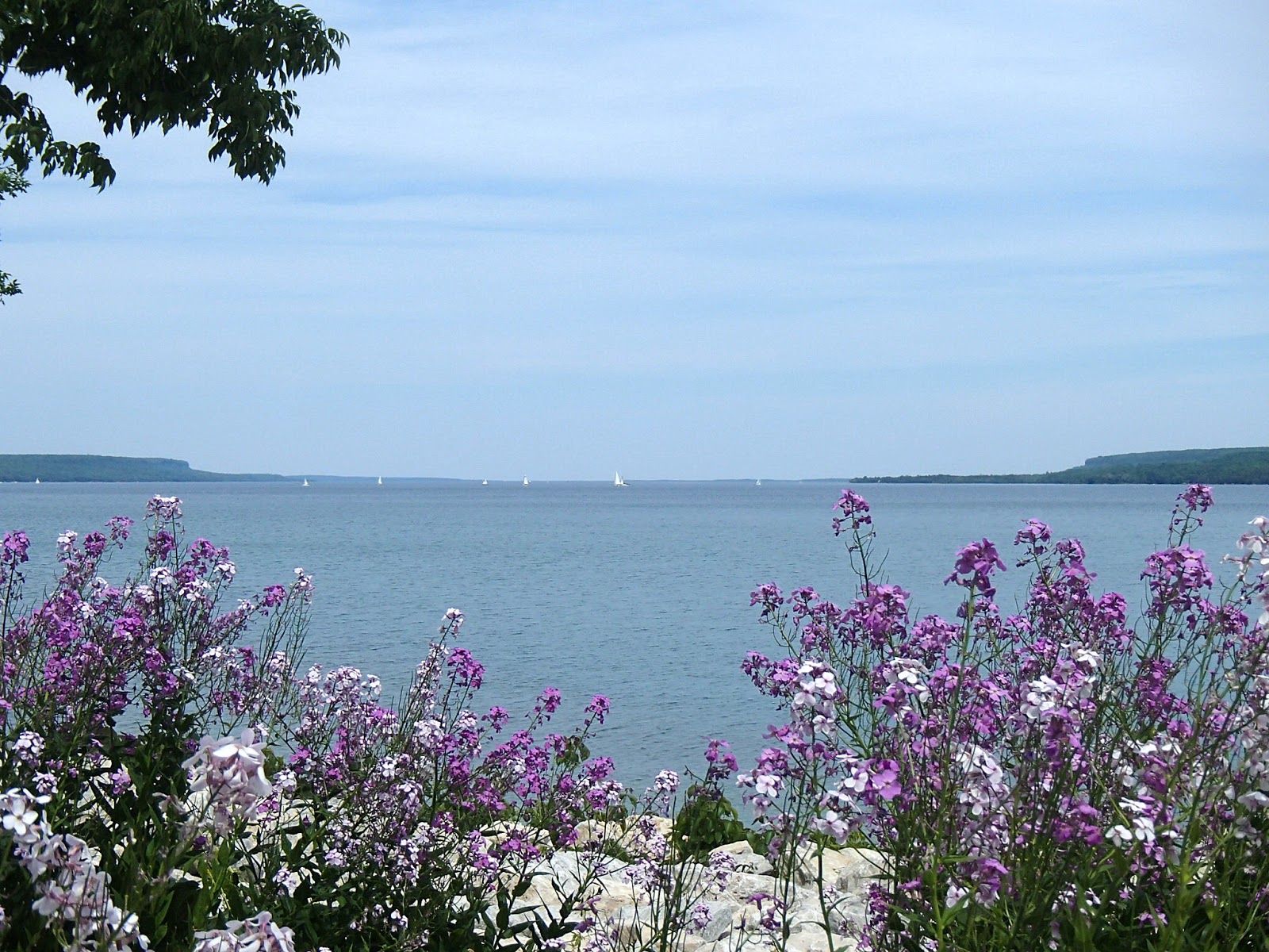
We continued towards Wiarton with a long 2.5km hike along Highway 1 looking north over Colpoy's Bay.

At the 164.3km mark the trail turned south and entered the Wiarton-Keppel International Airport property. The airport was built in 1948 as an emergency airfield for flights travelling between Toronto and Winnipeg. Today the airport is municipally owned and operated. Of significance, Governor General, the Honorable David Johnston, arrived and departed the airport for his May 2016 visits to Owen Sound and Meaford. Here are some photos around the airport.


At the 167.5km mark we entered the town of Wiarton, with the trail following streets into town towards and along the waterfront to Colpoy's Bay. At the waterfront we concluded the Sydenham section of the trail.

Wiarton was established in 1855 and by 1894 the population was 2000, similar to the population today. It is known as the "Gateway" to the Bruce Peninsula and is home to Wiarton Willy, the albino ground hog that each Ground Hog Day emerges to forecast the length of the remaining winter. Wiarton's climate is warm and humid in the summer and very cold and very snowy in the winter - the area receives on average 405cm of snow annually due to the surrounding waters. Here is Wiarton Willie - felt sorry for him as he looked old and not very happy in his cage.


We stopped at the car and picked up our cooler and had lunch at a picnic table on the waterfront looking out over Colpoy's Bay - a very nice and relaxing break!

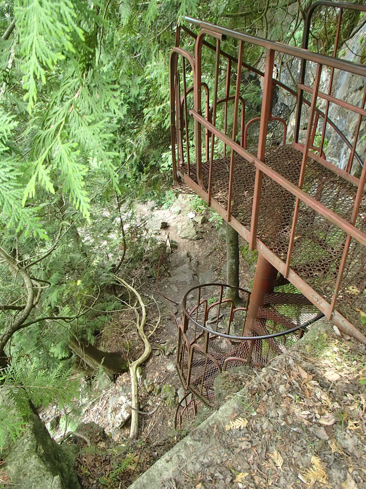
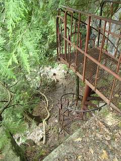
After lunch we headed north out of Wiarton along the base of the rising escarpment - beginning the Peninsula section of the trail - the last section of the Bruce Trail. At the 2.9km mark we arrived a steep climb up the escarpment to the "Spiral Staircase" which got us up the last 10 meters of elevation to the top of the escarpment. The area here is also known for the "Spirit Rock Lookout". Legend has it that a young First Nations woman jumped from the escarpment in this area and perished on the rocks below because her tribe disowned her for falling love with an enemy chief. Here are a couple of photos from this section.


We continued on the trail northeast through woods and fields to the 4.3km mark where the trail was recently re-routed. The trail headed further north and then crossed Highway 9 into a newly acquired/managed property called "The Vanishing Stream Nature Reserve". The trail cut across farmer fields - as we hiked the area proved very interesting as we came across many glacier carved rock formations including sinkholes and crevices with many very beautiful rock outcrops with flowers. This 105 acre property is a wonderful addition to the trail! Here are some photos from this last section along the escarpment and along this newly acquired property.


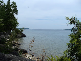
We continued through to the 5.8km mark around the waterside village of Colpoy's Bay. Here is a photo from Colpoy's Bay looking back towards Wiarton.


We called and got a taxi to pick us up and bring us back to the car in Wiarton.

Another wonderful Bruce Trail hike!

Completed:   733.2km

Sunday, 5 June 2016

Skinner's Bluff - Hike 42

I travelled north to do a day hike on the next section of the Bruce Trail. It was another beautiful and sunny day.

I met my brother who followed me to my end point where I parked my car. He drove me to the start of my day's hike at the 144.1km mark of the Sydenham section at Dodd's Hill.

The trail headed west off Kemble Rock Road along the top of the escarpment - there was some woods but mostly open and across outcrops of rock. Here are some photos from this section including the area around Graham's Hill Road and Big Bay Road, looking north towards the village of Big Bay and Georgian Bay beyond.


The trail followed Big Bay Road north for about 1.5km and then headed west along Cape Road to the 148.2km mark. At this point the trail headed west into the woods skirting the northerly side of the Slough of Despond. This place name is from a fictional, deep bog in John Bunyan's The Pilgrims Progress which the protagonist, Christian, sinks into under the weight of his sins and the sense of guilt about those sins. The ANSI (Area of Natural and Scientific Interest) designated area is actually a significant geographical example of a "bay mouth bar". This area was a bay on the glacial Lake Algonquin millions of years ago. When the glacial lake retreated, a barrier was formed across the bay mouth retaining the lake and wetland. Today there is a significant wetland area with a small lake or lagoon surrounded on 3 sides by the elevated Niagara Escarpment. Bruce Trail side trails travel along the upper escarpment to the south of the wetland. The main Bruce Trail follows Cape Road and along Colpoy's Range Road to the north of the wetland. Here are some photos from along Cape Road, Colpoy's Range Road and up the climb up onto the escarpment at the 152km mark.


Foundation of a pioneer structure.


From the 152km mark the trail headed north and then west along the top and edge of the escarpment towards what is one of the most picturesque parts of the Bruce Trail. The escarpment in this area is known as Skinner's Bluff and can be as much as 60 meters above the land below. The bluff affords incredible views to the north and northwest over Colpoy's Bay including Hay, White Cloud and Griffiths Islands.

White Cloud Island is famous for an early steamship, the Jane Miller, that sank off it's shore in 1881. It had refuelled at Big Bay heading to Wiarton and encountered a snow storm, capsized and sank. Oars and other debris was found on the island. Griffiths Island is home to a 2300acre private sports and hunting club established back in the 1970's. It is also home to a 26 meter lighthouse. Also of historical note, it is said that Samuel de Champlain, the early explorer landed on this island in 1609. Lastly, Hay Island is owned by a single landowner today - a lot of the island was used to grow hay as far as back as the 1850's when British troops were on the island.

Here are some photos along the Skinner's Bluff section of the trail.


Here are photos of my lunch - I sat on a rock on an outcrop with these views - stunning!


At the 157.1km mark of the trail, I took the Len Holley side trail south for about 1.7km to where I had parked my car and headed home.

Another wonderful day of hiking!

Completed:716.1km