In the meantime, in early to mid August I tackled a solo adventure that I had thought about doing for awhile now. I decided I would drive the famous Dempster Highway in north-west Canada, north through the Yukon and NWT to Inuvik and then fly to Tuktoyaktuk to see the Arctic Ocean. I had read about this highway a number of times over the past few years and had a fellow employee who motor-biked it a few years ago. I also wanted to see the Arctic Ocean. So, over a period of 7 days I drove about 2800 kilometers north and south in the Yukon and NWT, through some of the most amazing scenery and wilderness I have ever seen. The following documents the trip.
They began building the Dempster Highway in 1959 and eventually completed it to the village of Inuvik, NWT in 1979. The highway begins just east of Dawson City and heads north for 737 kilometers - it is the only road in Canada to cross the Arctic Circle. It continues to be recognized as one of the great wilderness roads to drive in the world. All but 5 kilometers of the Dempster Highway are gravel and many sections are very rough with pot holes and washboards - not an easy drive! Between the 0 kilometre mark and the 551 kilometer mark in Fort McPherson, there is only one service center with food, gas and accommodation - at the 369 kilometer mark. Making sure you have a full tank of gas and you fill up whenever you have gas available is obviously very important! In addition, other than in Fort McPherson and Inuvik, there is no cell phone coverage available, so help is only available from other travellers on the road. As far as other summer travellers, relative to the winter months, there are quite a few commercial and tourist based travellers but on average this amounted to seeing a few cars approach or pass you ever hour or so - so not a lot of travellers. Needless to say, I drove the Highway cautiously, averaging about 60-70km per hour. Many times during the trip it sunk in just how remote and vulnerable I really was on this road - but that was part of the adventure!
My adventure began with flying to Whitehorse in the province of Yukon and picking up my rental pick-up truck. Rental companies won't rent you a car if you are driving the Dempster as the road is too rough. On a number of occasions, as I will mention later in the blog, I was very glad I had a 4 wheel drive truck! Here is my rental - a 2015 GMC Canyon.

I headed north from Whitehorse on the Klondike Highway - a 6 hour drive to Dawson City to my first nights stay. The Klondike Highway itself was an incredible drive, travelling through mountains and skirting or crossing the mighty Yukon River a number of times. The Yukon River's tributaries start in the mountain of northern BC and flow north through the Yukon, through Whitehorse and Dawson City and then west through Alaska before flowing into the Bering Sea. Here are some pictures from this section of my travels.


The mighty Yukon River.


I arrived in Dawson City around 7pm and settled at my B&B, 5th Avenue B&B. Dawson City, with a population of about 1800, was founded in 1897 as a result of the Klondike Gold Rush. The population in 1898 ballooned to 40,000, mostly prospectors hoping to strike it rich, but dropped to 8000 a year or two later when the gold rush ended. The Dawson City area, at the confluence of the North Klondike and Yukon Rivers, for millennia has been an important area for the original First Nations Han peoples as fishing and hunting grounds.
I headed out to explore Dawson City. Very authentic looking with dirt streets and wooden boardwalks. The following photos are of Dawson City including Diamond Tooth Gerties Gambling Hall and Saloon where I watched the 10:30pm show with Diamond Gertie herself and dancing girls.


The famous Diamond Tooth Gertie's Gambling Hall and Saloon.


The Yukon River in Dawson City.

Someone's raft/home on the Yukon River!

Diamond Gertie herself.


Heading back to my B&B along the streets at 10:45pm!

The next morning I headed back east to the start of the Dempster Highway. Here are some pictures from the starting point.


I headed north into the Ogilvie Mountains and into the Tombstone Range to Tombstone Territorial Reserve which protects several thousand square kilometers of wilderness including Tombstone Mountain. Here are some pictures heading into Tombstone and of the famous Tombstone Mountain.

Tombstone Mountain below in the middle of the photo, highest peak in the range, about 20km away.


Fireweed, the Yukon provincial flower - it's everywhere!

I set up camp in the 30 site Tombstone campground and went for a 3-4km hike up Goldenside Mountain. A short but strenuous hike with some incredible views back down to my campground, towards Tombstone Mountain and looking north towards the Blackstone Plateau.


My campsite in Tombstone.


Here are some photos from around 11 to 11:30pm as I sat by my fire reading my book! It began to darken, but not to a full dark night until about midnight to 4am and then brightened again!


The next day I awoke to some rain so I tore camp down and went to the camp shelter to make breakfast - cereal with blueberries and coffee.


After breakfast I packed and headed north on the Highway with the next destination being Eagle Plains about 300km away. As I drove north I crossed over the North Fork Pass (the highest elevation above sea-level on the Highway) and onto the Blackstone Plateau. The plateau was a wide expanse of tundra for many kilometres either side of the road between mountains. Here on this plateau, and to the north, through the fall to spring, large herds of 1000's or as many as 100,000 caribou migrate from summer to winter grounds. Here are photos from this section.


From the Blackstone Plateau the road climbed into the North Ogilvie Mountains and through Windy Pass and then descended over about 30km into the Ogilvie and Peele River valley. Here are photos from this section of the drive.


High sulphur and mineral content in rocks made this river yellow/red in colour.


"Elephant on the Mountain" - if you look closely in the center of the photo below there is a rock formation that looks like an elephant from this angle.

Ogilvie River, which flows into the Peele River downstream.


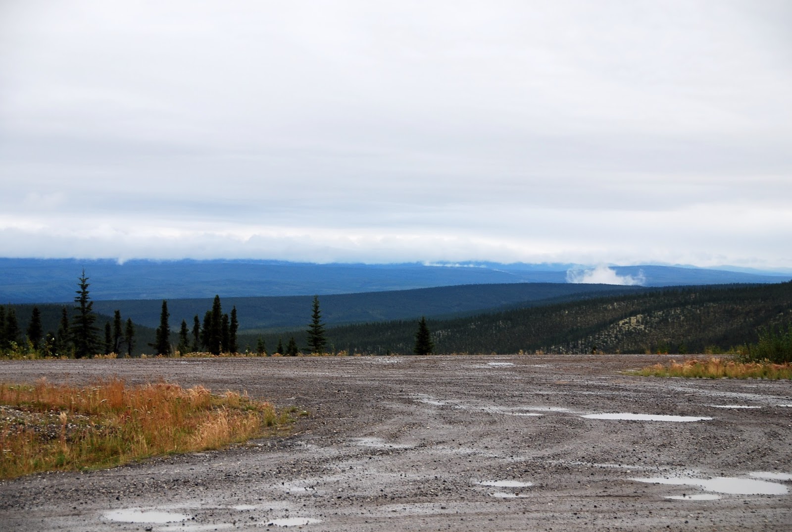
Once through the valley, the road steeply climbed "7 Mile Hill" a very long climb up onto the Eagle Plain plateau. Here are photos of the climb up and from the top of the plateau looking down onto the Ogilvie and Peel River valleys and north onto the Eagle Plain plateau.


Finally I made it to Eagle Plains, which is about the halfway point of the Dempster Highway and, as I mentioned earlier, the only place for gas, food and accommodations for many 100's of kilometers in all directions. Photos from the Eagle Plains area - note the population!


The next morning was again damp and overcast but I pushed out early heading north with my next destination being Inuvik. The following are some photos from this section including the point where I crossed the Arctic Circle. The Arctic Circle is at 66 degrees/33 minutes North. At this point and to the north, on June 21/22 each year, the sun never sets below the horizon - in total there are about 56 days of continuous summer sunlight. On the flip side, on December 21/22, the sun never rises above the horizon - in total there are about 30 days of continuous winter night.


Heading north from the Arctic Circle, the road passed through vast tundra with mountains in all directions. The road climbed into the Richardson Mountains and at the highest pass, it left the Yukon and entered the North West Territories. The scenery again was incredible - the vastness of the wilderness just took away your breath! Here are some photos from this section.


As I climbed the last pass into the Richardson Mountains, the weather was starting to clear but as I descended on the north side of the mountains, the clouds hung low so that I could only see about 50 feet in front or to the sides of the road. In addition, there was construction on this section of plateau coming down from the mountains. Fresh gravel + lots of rain and the road was a big messy mud pit at times. It took me almost 90 minutes to go 20km on this section and this was the one point on the road where I was truly a bit scared about what could happen - again, this was the point where I was happy I had a 4x4 truck!
North of the mountains, the road entered the Peele and Mackenzie River valleys. Here is a shot of the ferry to cross the Peele River. Also a photo of the second biker I saw riding the road north. I stopped to chat with him. He was from Australia and had started a month earlier in Alaska. He was a ship engineer and was on leave for a few months. As you can tell from him and his bike, he was a very colourful character!


Here is what my truck looked like after the day's muddy drive, as I stopped in Fort McPherson.

Here are some photos of the section of the road between the Peele and Mackenzie Rivers and the Mackenzie River ferry. The Mackenzie River is Canada's largest and longest river. Including tributaries, the river is 4,241 km long and the drainage basin is 1.8M Square km's. It's the second largest river in North America behind the Mississippi River. Bottom line it's a big river!


I was down to the last 130km's of road to Inuvik. Everything from here was pretty flat with lots of never-ending trees, lakes and swamps. Here is a Jeep that clearly hit a pothole or two too many and lost a wheel - no one was there so I assumed the person had got a ride into Inuvik to get help.


Picnic table.

I checked into my B&B in Inuvik, the Arctic Chalet. It was very nice. They have an adventure business that mostly caters to winter dog sledding with kennels for 35 all-white huskies. The next morning they brought out some of the dogs for a group picture, so I took a couple of pictures as well.


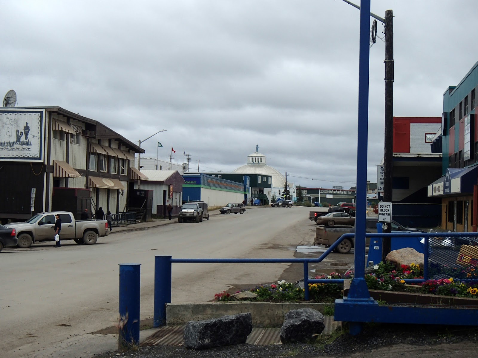
Inuvik was conceived in 1953 as a replacement village for the Inuit hamlet of Aklavik which was located on the Mackenzie River delta. The government re-established the village to Inuvik due to the flooding at Aklavik. Here are some photos of Inuvik including the NorthMart store (their Wal-Mart), the Catholic Igloo Church and the towns utilidors (above ground heated water and sewage piping due to the permafrost).


Muskox in Inuvik Visitors Center.

Polar Bear in Inuvik Airport.

I had dinner that night, and the next night as well, at Alestine's. This unique spot was in front of their house. They had an old school bus set up as the kitchen and a cute little building and deck for eating. They had a campfire going all the time with coffee and tea for those that wanted it. The specialty was white fish and the fish and chips and fish tacos were amazing!


The next morning I boarded a small plane and flew from Inuvik to Tuktoyaktuk. Tuk, as everyone seems to call it, is an Inuit or Inuvialuit village of 900 people on the Arctic Ocean. The Inuvialuit spelling of the village is Tuktuyaaqtuuq which means "it looks like a caribou". This area has been a location for caribou hunting for millennia. More recently, oil companies have come in and set up large operations for exploring oil and gas - unfortunately though, these operations have shut down leaving large vacant facilities (now owned by the village).


She also showed us her grandmother's handmade ceremonial jacket.

Eileen is one of a number of the community that still fishes and hunts traditional foods and smokes and prepares them for her own use and for sale. She showed us her smoke house and some whitefish that had been fileted and being smoked.


Whale vertebrae.

At this point I also got the opportunity to wade into the Arctic Ocean and it was cold!

Billie showed us his furs including various fox, caribou and wolverine as well as a muskox skull and a caribou skull and antlers. The first photo is of Billie in his polar bear pants and gloves. Also a photo of the harpoons they still use to catch whales, the skinning tools they use to clean meat off the skins/furs and lastly the traditional sunglasses they sometimes still use to protect their eyes from the sun off the snow in the winter. Lastly, a old picture of Billie when he was younger with a muskox he shot.


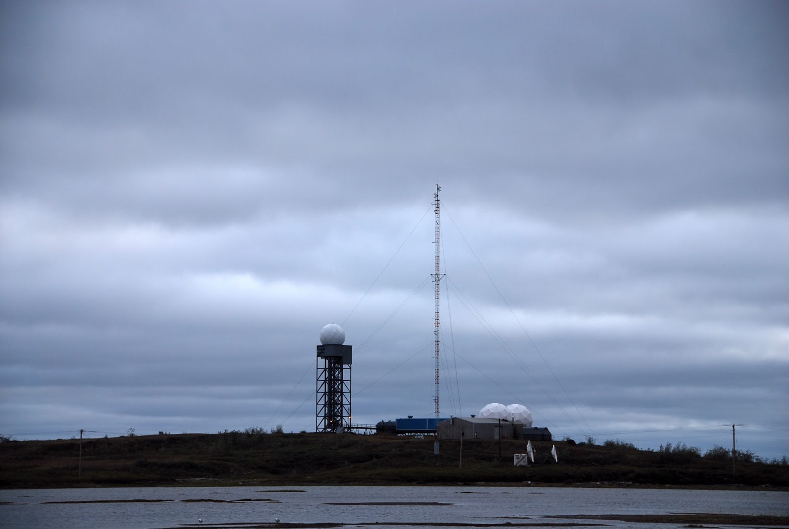
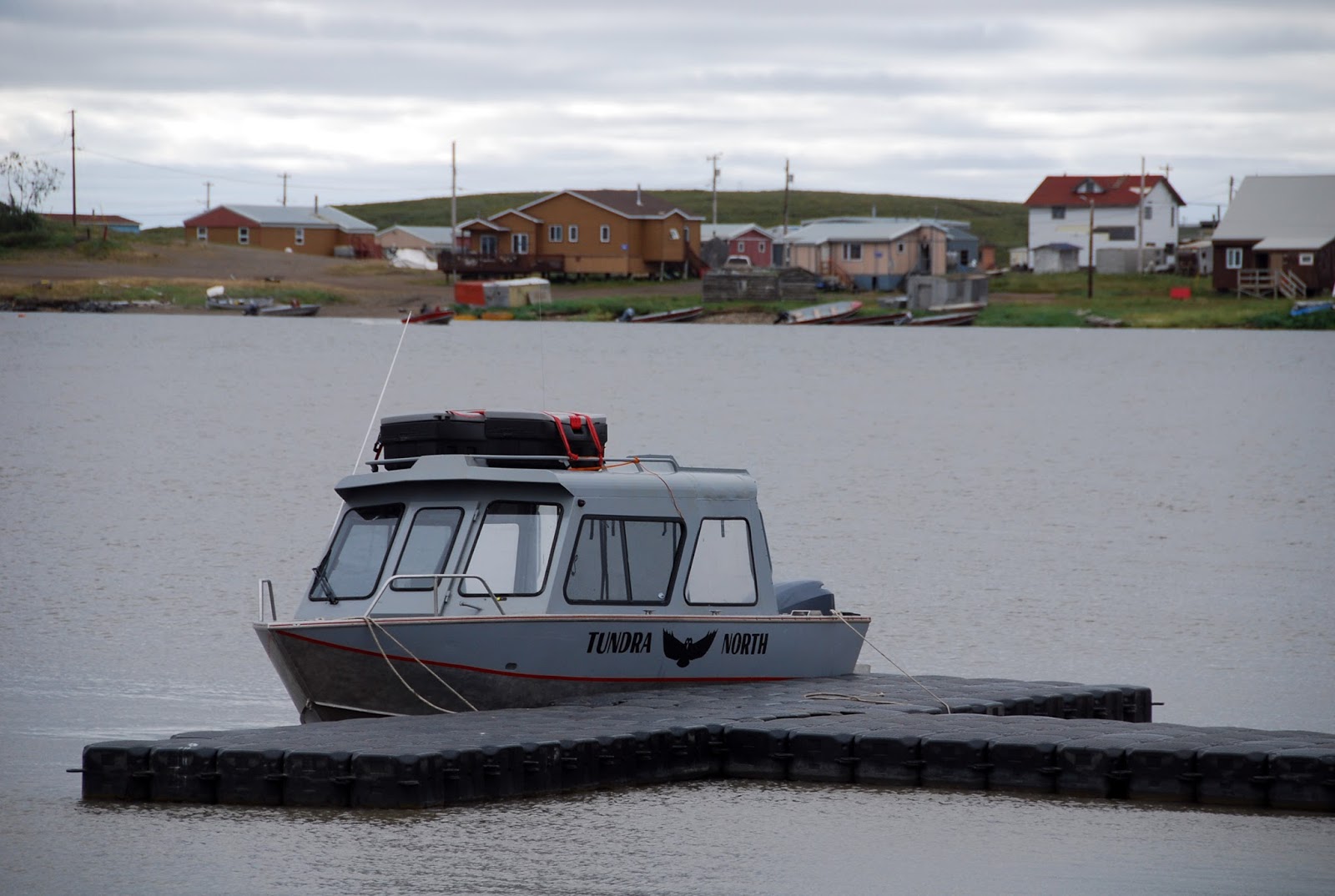
Eileen took us around the village to see various sites including the radar and NORAD site, the Anglican and Catholic churches, the ship used in the early 1900's to take children off to residential schools further south, today's school (kindergarten to Grade 12), traditional early sod houses, community center, cemetery, greenhouse and the traditional community cold storage (this door leads down 30 feet underground to a number of rooms that community members would store their meats within the permafrost) + other shots of the area and harbour.


Underground cold storage in the permafrost!


The school.


The greenhouse.

These are a couple of photos of the famous "pingo". These are areas where water collects and then freezes and the permafrost pushes up and forms these tall hills in an otherwise flat land.


We flew back to Inuvik late in the afternoon.
I had heard someone talk about seeing bears at the dump in Inuvik so I decided to go and check it out. I had hoped to see a grizzly in the wild but hadn't at that point so I thought the next best thing was to see them at the dump. Here are some photos from the dump from a couple hundred feet away.


I left Inuvik the next morning heading south on the Dempster Highway. Weather was nice and I got some very nice photos of lakes that were very calm in the morning.


Some more photos coming up to the Mackenzie River and the First Nations village of Tsiigehtchic (meaning mouth of Iron River).


Once I crossed the Mackenzie and Peele Rivers I headed back up into the Richardson Mountains, and since the weather was much nicer than when I came north, I got some nice photos of this section leading into and through the mountains.


As I came further south out of the mountains, and entered the Yukon again, a few more photos of the area in nicer weather.


More photos from the road heading back south towards the Arctic Circle again. Someone else was at the Arctic Circle so they took my picture. I was also ahead of schedule so I sat at the picnic table and read for about an hour looking out over the beautiful views!


Additional photos between the Arctic Circle and Eagle Plains.


I arrived and stayed in Eagle Plains again that night. I headed out the next morning in nice weather again and some more photos of the drive south over the Eagle Plains Plateau including a fading rainbow.


More pictures of the North Ogilvie Mountains and Blackstone Plateau leading back to the Tombstone Mountain campground where I stayed again that night.


The sky cleared that night and it was beautiful but cool - I was very cold in the night and woke to check the temperature in the truck and it was -2C. Here is my picnic table covered in frost and my breaky!


Again, very beautiful weather for my last day's drive south to the start of the Dempster Highway and then back to Whitehorse. Here are photos from this section of the drive.


I arrived late in the day in Whitehorse and checked into my B&B, Almost Home B&B. It was very nice. I spent the next day hiking along the Yukon River in and outside Whitehorse as well as walking and exploring the whole downtown area. Here are some photos from Whitehorse.


Late that day I toured the "Klondike" steam wheeler boat. It is the original ship and is a National Historic Site. The tour on board was very interesting. This boat was used early in the 1900's to carry freight up and down the Yukon River and later carried people, along with the freight, in elegance as you can see in the photo of the dining room through the kitchen.


One of my wishes for the trip was to hopefully see some wildlife in this great wilderness and as it turns out, I saw a fair amount. Here are photos of a rabbit, a bull and cow moose 15 feet off the road, a large bird possibly a golden eagle, a wolf, bald eagles fighting over fish, a silver fox (very inquisitive as it came right up to my bumper - photo was shot through my side view mirror) and a marmot (from one of my hikes). I did end up seeing both a grizzly bear and a single caribou cross the road a few hundred feet in front of me but both were too quick for me to take a picture.


So, that wraps up my blog of my adventure to the Dempster Highway and the Arctic. It was an very incredible trip that allowed me to see a part of Canada that not many people get to see and experience. Visiting and meeting the Inuit in Inuvik and Tuk was very special!
An ending note (one that I thought about many times over the trip) - even though we humans continue to negatively impact the land and climate in many parts of the Canada and the world, and obviously some parts of this Arctic region as well, travelling through these vast expanses of wilderness made me realize just how big parts of the world really are in relation to our relatively small urban/suburban day to day existence. As I've read a few times, including in one of David Suzuki's books, if and when humans become extinct, over time the earth will eventually heal itself and revert back to the way it was before humans evolved. This part of Canada that I travelled through, because there has been so little human based impact to date, is the way it has been for millennia. All the more concerning to hear about significant resource mining in the Peele River Basin and oil and gas drilling in the Mackenzie River delta and the Arctic Ocean. Hopefully we wake up before it's too late, to the fact that areas like this have to be preserved!
No comments:
Post a Comment