As described in my previous hike's BLOG, I had been planning to hike and camp on this next hiking section. Unfortunately that plan did not come about mostly because I ran out of time to find a local B&B or establishment to allow me to park my car at the end point and/or drive me to my start point. I decided to drop the idea of a hike and camp weekend and found a B&B and did my usual two days of hiking.
It was a beautiful sunny and relatively cool Saturday and Sunday in late June, so perfect weather for hiking.
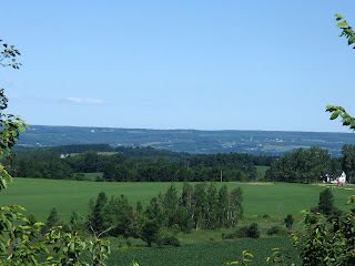
I had my B&B host help me drop my car in Walters Falls and then drive me back to my start point at the 107.5km mark of the Beaver Valley section. The trail headed south from Euphrasia St Vincent Townline through woods and continued south and then west through more woods and meadows along the upper edge of the escarpment.
Following are some photos of some nice flowers and plants along this section.
The trail met and crossed 7th Line and continued westward through woods and fields, again generally along the edge of the escarpment. At the 112.8km mark the trail passed Anthea's Waterfall, named after Anthea East, daughter of Dr. Tom East one of the founders of the Bruce Trail Club. Here are some photos from this section including some nice flowers and a memorial to a past BT member.
The trail came out on Grey Road 12 at the historic hamlet of Blantyre. Blantyre was settled in 1856 by James Patterson. By 1860 the busy village had 3 stores, a barrel make, various mills, a blacksmith, tinsmith, a hotel and school and two stagecoaches (one to Meaford and one to Owen Sound). James Patterson was the first postmaster and the Patterson family continued as the postmasters until the post office closed in 1924. With the arrival of the railway in 1870 the population of 150 declined quickly to today where it is almost a ghost town. On the west side of the road there is a very old, broken down shell of a building which I assume must have been a store or hotel of some type. The Beaver Valley section of the Bruce Trail ends at Blantyre and the Sydenham section begins.
The trail continued west from Grey Road 12 again through woods and fields along the top of the escarpment. At the 1.2km mark of the Sydenham section, there is a side trail leading down the escarpment a 100m or so to a camp site location, maintained by the local trail club. The 3 sided, open door shelter with bunks make for a nice shelter to set up in. This was the campsite I was originally going to shoot for to camp overnight. With the weather warming and increased humidity and with the campsite down below the escarpment, the bugs were thick and part of me was quite happy that I wasn't stopping and camping overnight - on the other hand, in the fall it would probably be a nice spot to stop and camp. Here are some photos of this section and the Ambrose campsite.
It was also along this section of the trail I got two adrenaline pumping situations. First, as I walked along the trail a ruffed grouse flew out of the bush beside the trail. This has happened a few times in the past but this time it was very close to the trail and startled me big time. In the past the bird would fly off and disappear into the woods. On this occasion though the grouse actually started to fly at me a number of times and then followed me on the ground for 15-20 feet making hissing noises - that was a new experience! I can only assume it had a nest close by and was in protection mode. Not long after this, in a fairly dense section of the woods on the escarpment, again all of a sudden, there was some loud huffing or grunting noises coming from ahead on the trail. It was clearly from something big. I had assume it was a bear and froze not sure whether I should continue. The noises continued so I backed up the trail a bit but in the end decided I couldn't go back and just started making some loud noises and started forward. I didn't hear anymore of the noises and didn't see anything but I can only assume it was a bear - not sure what else it could have been.
The trail came out on Deviation Road and re-entered a field on the west side of the road. The trail crossed Rocklyn Creek and then climbed steeply to woods continuing westerly to St Vincent Sydenham Townline at the 7.5km mark. The trail followed the Townline south up a steep hill back up onto the escarpment. The trail headed back into woods and fields along the top of the escarpment and then descended to the valley coming out on Grey Road 29 at the 10km mark.
The trail headed south crossing Grey Road 29 a couple of times and then followed Walters Creek up stream through the valley to Walters Falls.
Walters Falls was settled in 1850 by John Walter of Somerset, England. The settlement was originally known as Walters Place. He built a mill at falls and the first post office was built in 1855. The sawmill burned in 1984 but woolen and feed mill still stand today. In fact, the feed mill continues to be a thriving business in town still operating using water power.
I picked up my car and headed back to the B&B, Chrysalis Ranch B&B, just outside Walters Falls. Chrysalis is a horse ranch and working farm and the accommodations and service were great. That night I went into Meaford and had dinner at the Leaky Canoe - food and the Corona were great!
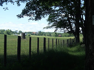
Next morning my B&B host helped me drop my car at my end point and then drove me back to Walters falls to the start of my day's hike. The trail picked up crossing Walters Creek above the falls and headed back north along the west side of the valley. The trail continued to head north past Grey Road 29, past Holland Sydenham Townline, following along beside and above Walters Creek. At the 13.9km mark the trail turned and headed west along a fence line to 2nd Concession. Here are some photos from this section.
The trail followed 2nd Concession south for 600m and then turned west and followed Holland Sydenham Townline for 2.7km. Here are some shots from this area including photos of a very picturesque Holland Sydenham Cemetery.
At the 17.8km mark the trail turned north and followed 4th Concession crossing the Bighead River near the 18.9km mark. The Bighead River originates inland near Chatsworth and flows through the Bighead River valley and empties into Georgian Bay at Meaford. The Bighead River is a prime river for steelhead trout fishing in spring and fall.
From here the trail turned west through a meadow and past a private property and house and then steeply climbed the escarpment to the 20km mark. It continued west for about 1km and then turned north through woods and fields to the 22.1km mark at Sideroad 3 where I parked my car. Here are photos from this section.
Another wonderful two days of hiking!
Completed: 581.0km


No comments:
Post a Comment