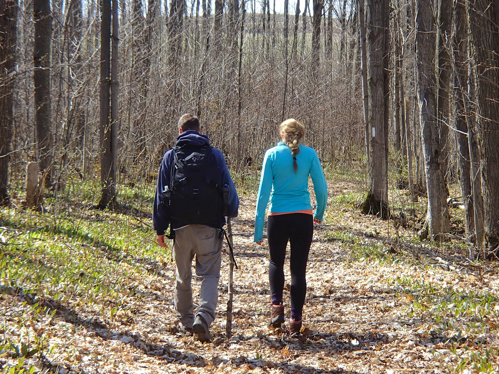
We had our B&B host drive us out to park our car at our finish point for the day and then drive us to our starting point. Our hike started out at the 37.6km mark of the Beaver Valley section, heading south along the eastern edge of the Beaver Valley
The Beaver Valley is home to the Beaver River which runs northeast through the valley reaching Georgian Bay at Thornbury. First European settlers travelled up the Beaver River by canoe in the 1850's as far as Eugenia. Along the Beaver River, in the base of the valley is a very large lowlands area known as the Beaver Valley Lowlands - as you drive the highway through the valley you will notice that large area of marsh/swamp that borders the river. It is believed that there was an abundance of beavers in the area at the time leading to the name of the river and the valley.
The trail descended and followed below the escarpment for some distance to the 39.4km mark where there was a spectacular natural pass up through to the top of the escarpment. Here are some pictures of this area.


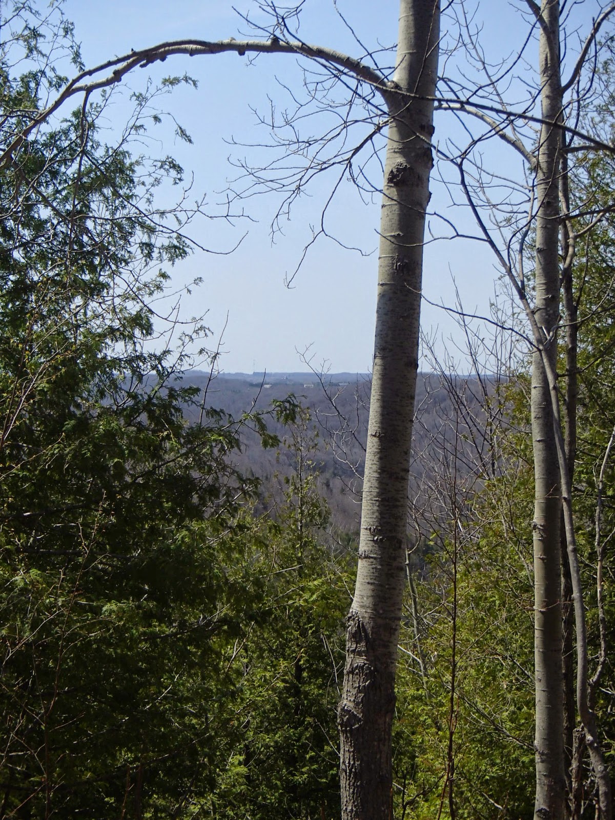
The trail continued along the top of the escarpment with beautiful views out into the valley and the ski resort on the western edge of the valley.


At the 41.8km mark the trail followed Sideroad 7B for a short distance before entering the Old Baldy Conservation Area parking lot. The trail continued out of the lot towards Old Baldy.
Old Baldy (named as such because the escarpment outcrop appears as a bald spot) is, at it's highest point, 449.6m above sea level and 230m above the valley floor. There are parts of the escarpment cliff that have as much as 30m of vertical rock face. It is a very popular place for rock climbing. The view off Old Baldy looked down on the village of Kimberly. Established in 1868 the village had a post office, sawmills, grist and flour mills, two hotels and 3 blacksmith shops. In 1880 a brickyard was opened on what is today the Talisman Ski Resort. Here are some pictures from Old Baldy and area.


The trail continued south along the escarpment before heading inland and meeting up with 4th Line, which it followed for about 2km before meeting the Artemesia-Euphrasia Townline. The trail followed the Townline for 1.5km.


We finished up the day's hike at the 47.9km mark and drove back to the B&B.
We stayed the night at the Guest House B&B in Eugenia. Rosanna and Wolfgang were our wonderful hosts. They have a beautiful spot near the Eugenia Falls. Their website is www.theguesthouseateugeniafalls.yolasite.com
That night we drove into Thornbury and had dinner at The Dam Pub, a pub famous for their world class whiskey inventory - they have 736 different whiskey's for tasting including a whisky that was $615 for 1 1/2 ounces!! The ribs and fish and chips were great!! Here is the website www.thedampub.ca.
On the Sunday morning our B&B host dropped us at our starting point at the 47.9km mark. Notes from the Bruce Trail guide state that this next 29km section of the Bruce Trail, which was added in 2008, is known as the "Falling Water" section due to the number of streams flowing off the eastern edge of the escarpment. Hats off to the Beaver Valley club for all the hard work and persistence in working to secure access to this section of trail!
The trail headed into woods towards the escarpment at the 48.4km mark and followed below and above the escarpment through to about the 51km mark where the trail came out on the OPG penstocks carrying water from Lake Eugenia to the generating station in the valley. In 1913 the Ontario Hydro Electric Commission purchased 1900 acres of land, dammed the river and flooded the land, which created today's Lake Eugenia. They built about 1600m of pipes or penstocks from the lake to the edge and down the escarpment to the Eugenia Generating Station. At it's peak the station was generating 4500kw of electricity. The Eugenia station has the highest head of water (180 meters) of any OPG generating station. The trail climbed beside the penstocks up to the large surge towers at the top of the escarpment. Here are some pictures from this section of the trail.


The trail continued south along the escarpment edge through woods and meadows until about the 55km mark when it started to climb steeply to a spectacular lookout over the Eugenia Falls and Cuckoo Valley. Aboriginals and early settlers called it this name due to the large number of Cuckoo birds nesting in the area. Here are some pictures from the lookout.


Prior to the climb to this last lookout at the 55.4km mark and after the trail descended to the river and falls, there were two old stone arches that the trail passes. These arches are at either end of a tunnel that was built by the Georgian Bay Power Company in the early 1900s in an attempt to divert the river to a spot on the escarpment that would create a greater head of water and more electricity generation. The plan was abandoned though and the tunnel was later filled in for safety reason - the two arches are all that remains today. Here are pictures of this area.


The trail descended to the edge of the river and Eugenia Falls which at abut 25 meters is spectacular. Not a lot of water running over the falls when we were there but still beautiful. Here are some pictures.


The trail then continued back along the river where it met and exited onto Highway 13 in the village of Eugenia, crossed the river and veered right back into the woods along the south side of the river.
At this point we finished our hike for the day. We arrived at our car which we had left at the B&B in Eugenia and thenheaded home for the day/weekend.
Another wonderful weekend of hiking.
Completed: 500.1km
2 comments:
Interesting blog and would love to hike but have a wonky knee. Is that a way to view the penstocks getting there by car?
Thanks for the comment - this whole Beaver Valley section is incredibly beautiful and yes, you can access the trail and a short hike to the penstocks at the top of the valley edge. Too bad about the knee.
Post a Comment