I drove and parked my car at my end point and called a local taxi company and had a taxi in 10 minutes - 15 minutes later I was at Inglis Falls for the start of my hike.
I picked up the trail just west of the falls at the 91.5km mark. The trail led through a wooded area and then crossed Inglis Falls Road and turned north into a field.


The trailed continued north and west through woods and fields to the 93.7km mark where it met 2nd Avenue S/E.

The trail followed the road and turned north on Concession 3 for about 1.2km before turning east into the woods and towards the escarpment. Here are some photos from this section including a lone pig in a pen at the side of the road!


The next 5km or so of the trail followed the edge of the escarpment with many beautiful views out over different parts of Owen Sound.


Looking north along the western edge of Owen Sound harbour - the Bruce Trail eventually climbs that small hill in the distance, Kemble Mountain - a couple of hikes into the future.


Historic Owen Sound grain elevators.


The trail between the 98 and 100km marks provided for some very exciting hiking as I encountered many crevices that crossed the trail. Some of these crevices were only 6 or 8 inches wide so a short step gets you across. The largest was probably 15-18 inches and, definitely for me, required a few minutes to gather my courage to step over. Some were only a few feet deep but many were 20-30 feet deep and some you couldn't see the bottom. Definitely made for some adrenaline filled moment over this section of the trail. Here are some photos.


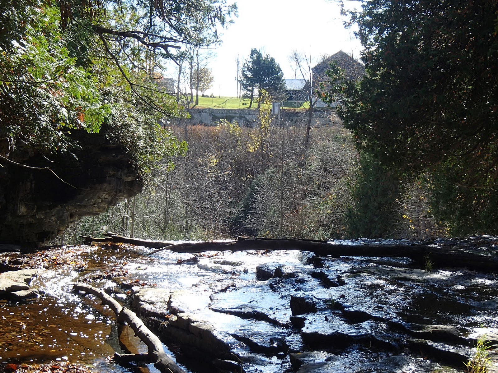
The view from where I was sitting by the river having my lunch!

The trail headed north through the Pottawatomi Conservation Area, along the escarpment edge to Derby-Sarawak Townline. The trail crossed the road and followed West Street north for about 600m. At the 103.6km mark the trail turned east into the woods and headed back towards the escarpment edge. The trail followed along the escarpment edge for 1.2km and again provided for exciting times with many "leaps of faith" over crevices both small and large.


Here are two section of escarpment that have broken away and a photo of a "flower-pot" rock formation in the woods.


At the 104.8km mark the trail descended the escarpment and into a residential area of northwest Owen Sound. For the next 2.5km the trail followed residential streets to the north finally reaching farmland at about the 107km mark.


The trail followed Range Road north to the 107.5km mark where it met the Georgian Bluff Rail Trail.
This where I had parked my car.
Lesson for this day was that if I hiked this section again or recommended it to someone else, I would highly suggest not hiking alone or in wet or snowy weather. Most of the crevices are an easy step but a few required a bigger step or small jump and if there ever was a slip or fall into one of them, you would be in trouble - probably not a good idea to hike alone. Again though, the crevices added some adventure and excitement to the hike!
Another wonderful day of hiking
Completed: 666.4km
No comments:
Post a Comment