I got my brother to drop me off at my start point at the 68.9km mark of the Sydenham section of the trail. I heaved on my 35+ pound pack and headed north from Sideroad 22 into the Sydenham Forest East. The trail headed north then west and then southwest back to meet Sideroad 22 at the intersection with 6th Concession North.


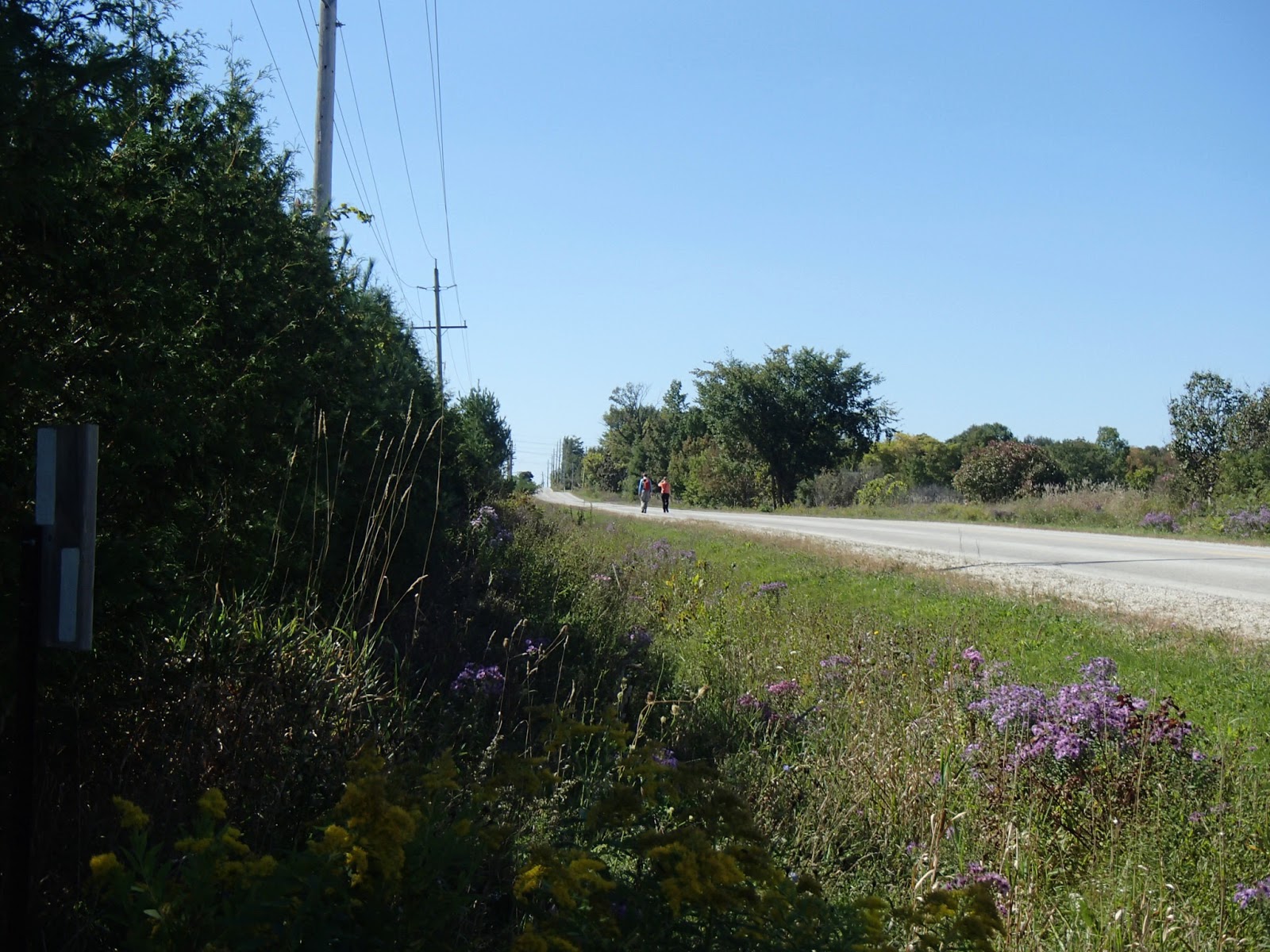
Here are some photos from the section between the 70.9km and 72.7km marker.


At the 72.7km mark the trail met 8th Concession North and followed the road southwest to the 74.3km mark, heading into the woods.

Very interesting Heritage Tree - signed by a Polish soldier who had been raining in the area in 1942. The etching on the tree are still pretty clear!


The trail met Highway 26 near Bothwell's corner, crossed and then headed east for a short hike up the south side of the busy highway (above photo).
The trail headed south off the highway following below the escarpment through to about the 77km mark where it climbed up onto the escarpment continuing through some nice wooded areas.


At the 78.4km mark I took the Rock Springs Side Trail to the KOA Side Trail arriving late afternoon at the Owen Sound KOA Campground. I got a very nice tent site and set up in the sunny and warm weather. What a wonderful camp experience. The KOA camp was very clean and well run with incredibly nice washrooms and facilities. I cooked up my dinner that night and started a fire which I sat beside and read until it got dark and then read some more with my headlamp once it was dark. It was a beautiful night - clear with a full moon that lit up the area as if it was dusk. A photo of my camp site.

Next morning I awoke to another beautiful day, had breakfast, packed and headed out by 9am. I followed the side trails back to the main trail at the 78.4km mark. The trail headed west along a inaccessible road that eventually turned into 15 Sideroad.


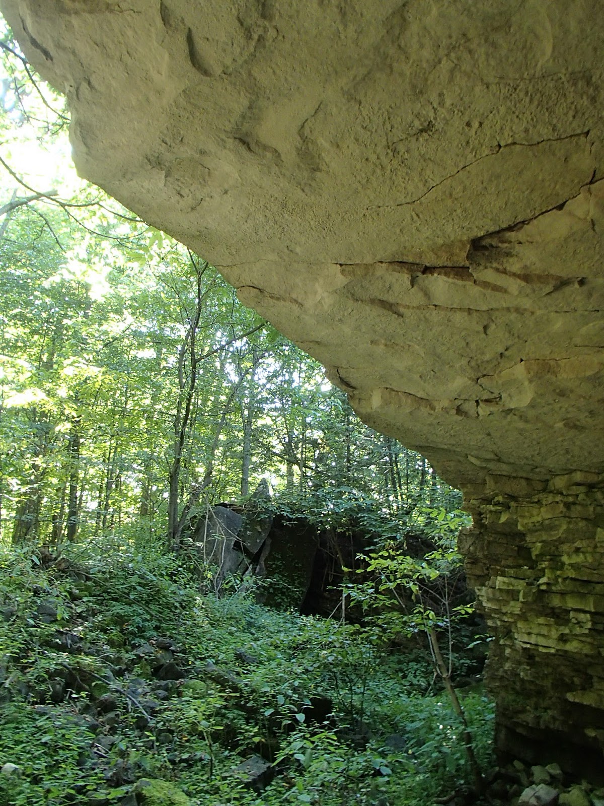
The trail continued south along 10th Concession South to the 80.7km mark where it turned west and entered the woods below the escarpment. The next couple of kilometers were some of the most interesting and intriguing parts of the trail to date. Along this section, the trail followed below the rock escarpment but at times ventured into large and long cracks in the escarpment. Here are some shots from this section.


This was a highlight but a tight squeeze with the big pack!


The trail skirted a local Owen Sound golf course.


The trail continued west and then north west crossing the Keeling Side Trail (above) and eventually coming out on Superior Street, which it followed west to Highway 6/10.


The trail followed Highway 6/10 south a short way and then crossed and entered Owen Sound's Centennial Park. The highlight of the park is the Centennial Tower, built by two local high schools to celebrate Canada's 1967 Centennial. The tower fell in major disrepair and finally in 2000 the City of Owen Sound and the Province of Ontario provided funds to restore the tower. Climbing the tower provides a beautiful view of the city and surrounding area. Here are some pictures from this section.


The trail then headed down below the tower and followed along below the escarpment. This section was very challenging as it followed below the high rock escarpment and through the scree - up, over and around lots of rocks, big and small. Here are some photos from this section.


At the 87.1km mark I took the Harrison Park Side Trail to the west which steeply descended the escarpment to a residential area. The side trail continued through Harrison Park eventually meeting and following the Sydenham River southward and further into the park.


About 2.5km later I arrived in the heart of Harrison Park and checked into the city owned campground. I had visited this park many times when I was younger as my aunt had lived in Owen Sound for many years. I recognized many parts of it. The park covers about 40 acres along the Sydenham River between the east and west edges of the escarpment. My tent site was nice - beside a small creek that flowed into the river. The park was nice but unfortunately for this specific weekend, the park was hosting a baseball tournament - there were lots of teams camping and partying late into the night so it wasn't very restful.
I was up eating breakfast by 8am. In my previous days travels I had found some nice small apples along a farmers field and picked a few. I sliced up the apples into my oatmeal - a nice treat!
Once packed I headed back along the Harrison Park Side Trail, back up the escarpment to meet the main trail at the 87.1km mark. The trail continued south along and below the east escarpment. Again, it remained very technical and challenging as it traversed the escarpment scree, up and down, over and through rocks and crevices/gaps. A side trail at the 88km mark took me up to the Raven's Nest - a high point on the escarpment with nice views out over the valley - here are some photos from this section.


Just off the Raven's Nest Side Trail was an car scrap yard - strange seeing this so close to the escarpment and trail!

At the 88.5km mark the trail dropped down below the escarpment and continued through the valley meeting up near the Sydenham River again. Here there were some tributaries of the river that, as I read on the information plaques, were man made to help salmon travels upstream around falls and rapids for spawning. Sure enough, as I stopped to cross over one of these tributaries, there were two very large salmon swimming upstream.


The trail ascended the escarpment again and around the 91km mark entered the Inglis Falls Conservation Area. At the 91.5km mark the trail crossed just above the centerpiece of this park, Inglis Falls. At 18 meters in height the falls are very spectacular! This area was first settled in 1843 by Peter Inglis. In 1845 he purchased an existing grist mill plus 300 acres in the area. In 1862 he built a new grist mill as well as a sawmill downstream from the falls and a wool mill at the falls. Peter's son William managed the facilities until 1932 when it was obtained by the City of Owen Sound. Here are some photos from this area.


The hike this day had been tough along the east side of the escarpment and given it was my third day of hiking with a 35 pound pack, I was really running out of steam. I decided to end my hike there at the Inglis Falls parking lot. I called my brother who came over and picked me up.
This was a great few days of hiking and camping and was a good test of how much through-hiking/camping I can do. Hopefully as I head further up the escarpment (most of which now will be in 2016) I hope to do more and longer through hikes/camps.
Completed - 650.4km
No comments:
Post a Comment