Monday 17 June 2013

Reminiscent of LOTR - Hike 5

Sunday, May 26 I headed out again on my own for my 5th hike on the Niagara section of the Bruce Trail and again, the weather was perfect - beautiful sunshine and temperatures in the low 20's C.

I parked my car at the parking lot at the top of the escarpment at Quarry Road at the 65.0km mark on the trail.


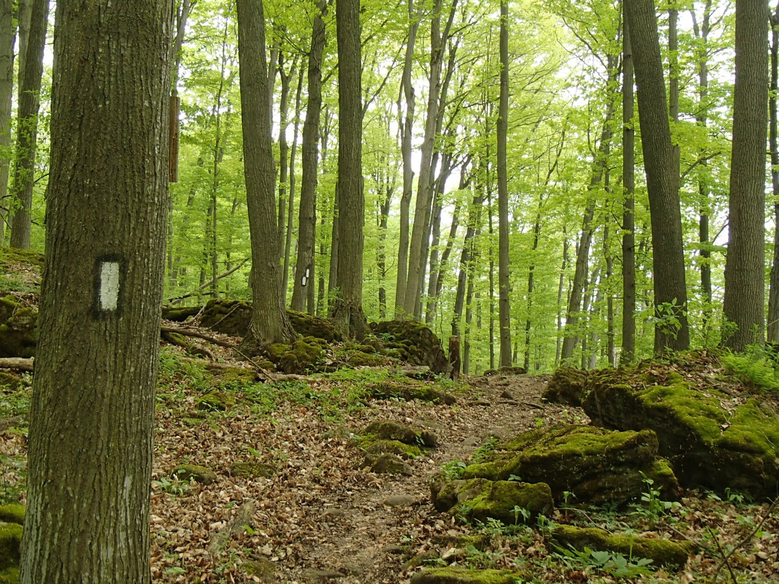
The trail generally followed the top of the escarpment through to about the 68-69km mark of the trail and then descended through some beautiful forested areas.


The trail then came out onto flatter farm lands with many vineyards and wineries including what appears to be a soon-to-opened Mike Weir winery!


Again stunning views out over Lake Ontario towards Toronto.


The trail headed back into the bush along the escarpment through to the 76km mark and then cut out to Ridge Road in Grimsby. The trail followed along Ridge Road for a few km's passing many beautiful homes looking out over the lake.


Once you arrive and cross Mountain Road in Grimsby you go back into the bush travelling along the bottom of the very steep and high escarpment.

At the 79.5km mark of the trail I came across something that was the highlight of the day. From below the escarpment, walking through the forest, my eye caught a structure up the slope tucked into the edge of the vertical rock face of the escarpment. My family will get a chuckle but the first thought that came to mind was the "Lord of the Rings" movies. For those who are LOTR fans, the characters in the movies are forever walking through forests and coming upon ancient structures and statues. I walked up the slope to get a closer look at the structure - it was obviously very old and I was totally perplexed as to the purpose, located way back into the forest tucked up against the wall of the escarpment. Take a look at these pictures - what was this built for?


From here it was only 500 meters or so descending down to Gibson Street in Grimsby where I crossed the bridge at Forty Mile Creek.

My wife met me and drove me back to my car.

The total tally for he day was 15km.

So, as to the mystery of that structure, once I got home I searched "structure, Bruce Trail and Grimsby" on the internet and to my surprise, there was some posts talking about the same structure in these pictures.

It appears from the information on line that this structure was built around 1915 and used up to 1970. The round cement pad part of the structure is the top of a very large underground water reservoir for the Town of Grimsby. The story seems to go that a pumping station located at the mouth of Forty Mile Creek at the Grimsby shoreline a few kilometres away, would pump water up into the reservoir for use by the town. Someone would climb a tower at the pumping station at the lake, look through a telescope or binoculars up at the escarpment to this structure on top of the reservoir pad and a float device would tell them that the reservoir was low and they needed to pump more water up into the reservoir. Kind of hard to believe but I'm assuming that the article was correct and that is what it was used for - amazing what you find along the Bruce Trail!

Looking forward to my 6th hike!

Completed: 80.0km

Tuesday 11 June 2013

Balls Falls & Twenty Mile Creek - Hike 4

Sunday, May 12 again was a beautiful day. I headed out for my 4th Bruce Trail hike.

I parked in the parking lot at the side trail off the Bruce Trail at the 49.3km marker.

At the 50.3km marker I travelled north on Seventeenth Street for 1.3km along fields of grapes vines.


There was wonderful views across Lake Ontario to Toronto as well.


At the 53.7km marker I started the hike up the Twenty Mile Creek valley. This was a stunning walk through large deciduous and coniferous trees along a rushing river cascading over many large rocks. You would think you were walking along a river in Muskoka - just beautiful.


At about the 54km mark there was a very steep climb out of the valley, up switch-back steps and ropes to the edge of the escarpment at Ball's Falls.


Twenty Mile Creek cascades over the escarpment at Ball's Falls. There is an Upper falls at 11 meters high but the very impressive sight is the Lower falls at 27 meters high - that's 2/3 the height of Niagara Falls.


The village of Ball's Falls was built around various mills including saw, grist and woolen mills. It was a bustling village of 19 people back in 1852. Today it is one of only a few "Ghost Towns" in Ontario. The property and structures are part of the Ball's Falls Conservation Area and include the mill, homes and a church.


After leaving Ball's Falls, the trail travelled along the upper and lower parts of the escarpment. The trilliums were in bloom everywhere.


At one point I came across a unique little farm with goats!


And a famous Bruce Trail stile!


And a winery with vineyards.


Around the 61km mark, the trail was below the escarpment through a beautiful hardwood forest. The trees were all very tall with a high leaf canopy and very little undergrowth. With the leaves all just starting to open and everything very "green" and very quiet, walking though this forest felt almost mystical. The picture below does not do it justice.


A trail sign of historical significance to the Bruce Trail.


The last portion of the trail climbed steeply to the escarpment and then hugged the edge of the escarpment through to the 64.5km point of the trail. Along this part of the trail I had a visitor (not sure if he thought I was on my last legs and represented dinner) and many views down over the edge of the escarpment to the many vineyards below.


I finished the day's hike at the parking lot at the 65km mark. My wife met me and gave me a ride back to my car.

The tally for the day was 16.9km.

Again, I'm already looking forward to the next hike!


Completed: 65.0km
 

Short Hills but a Long Hike - Hike 3

I headed out on my 3rd hike on the Niagara section of the Bruce Trail on Sunday, April 28. Again the weather was beautiful - sunny and warmer, around 20C.

I parked my car at Morningstar Mill at the 33.5km mark of the trail.

After a short walk along DeCew Road, the trail headed into the bush and into Short Hills Provincial Park.


What a wonderful and beautiful park! The park is a day-use only park with many, many trails for hiking, horse back riding and mountain biking. The park gets it's namesake from all the small rolling hills left by the retreating glaciers.


At the 36km mark the trail takes a sharp right turn and heads along Terrace Creek which gradually runs through a deeper and deeper ravine and gorge ending at the Terrace Creek Falls.


Throughout the walk spring was evident with all the native flowers ready to bloom or blooming.


The trail continued through the park through beautiful forests and meadows.

At the 40.5km mark the trail rises to an observation deck looking over Swayze Falls.


The trail finally leaves Short Hills and continues along the escarpment to Rockway where there is a 15 meter high falls cascading into another deep gorge.


Continuing past Rockway, the trail follows along the top of the escarpment and then down through some lowlands where, given the recent rain, it was very muddy and wet. I came across this tree with an interesting flower - still researching to find out what kind of tree this is.


Near the 49km marker I climbed back up the escarpment, past Sixteen Mile Creek and this waterfalls.


My hike finished at the parking lot accessed by a side trail at the 49.8km mark of the trail. My wife met me and drove me back to my car.

The standout for my hike that day was Short Hills Provincial Park. Even though it's not far outside of St Catharines the day-park nature of the park and it's size made it feel like you were somewhere in the wilderness. This will be a place I come back to for another hike or for a mountain bike ride.

Next hike - 2 weeks!

Completed: 49.3km

Sunday 9 June 2013

The Welland Canal & DeCew Falls - Hike 2

It was Sunday, April 14, 2013 and I headed out on my own to hike the second segment of the Niagara section of the trail. It was a bright and sunny, but cool (8C), spring day.

I parked my car at the parking lot just east of the Welland Canal at the 18.2km mark of the trail.

Leaving the parking lot I crossed the Welland Canal Glendale Avenue lift bridge and hiked south along the western edge of the canal before heading into the woods.


The next 3.5km was through fairly urban parts of St. Catharines. At the 22.6km mark of the trail I climbed steeply up through a residential area on Tremont Drive and at the 23.5km mark I entered back into the woods along the top of the escarpment.

Just past the 25.3km marker, the trail passed though and around Brock University.


At the 26.8km mark I came to on an unexpected site that totally surprised me - something that I hadn't heard of before. There was a channel of fast moving water flowing into a building at the edge of the escarpment - as I found out it was the DeCew Falls Generating Station.


Doing some research I discovered that the DeCew Generating Station was built in 1898 and is the oldest continuously operating hydro electric station in Canada. It draws water from reservoirs called Lake Moodie and Lake Gibson further south from the escarpment. The water is channelled through pen stocks down 260 feet of drop over the escarpment, into the generating station, turning turbines to generate electricity and then exiting into Twelve Mile Creek. This was a very impressive site!

The trail then circles Lake Moodie past the historic DeCew House.


Legend says that American officers were billeted at the Secord house in Queenston during the War of 1812. Laura Secord, wife of a Canadian militia officer, overheard the US plan to attack the British and was reputed to have travelled on foot over 30km to the British headquarters at the DeCew House, to warn them of the attack. As a result of her warning the British were prepared and scored a major victory over the US. Very interesting to see the remains of the DeCew House.

The trail continued around Lake Moodie and back to the edge of the escarpment and continued there for a km or so to the next big surprise of the day, DeCew Falls and Morningstar Mill at the 33.5 mark of the trail. DeCew Falls is stunning at 22 meters in height - the water tumbling into a deep gorge. At the brink of the falls is Morningstar Mill. The mill and surrounding buildings were built in 1872 and are now a museum.


My wife met me at Morningstar Mill and drove me back to my car.

The tally for today was 15.3km with several very interesting sites. I was amazed at the things I saw that day that I didn't even know existed, all within an hour of where I live. As I would find out on subsequent sections I hiked, there were many more unexpected, amazing sites and scenes to come.

Again, very much looking forward to the next hike!

Completed: 33.5km