I went out on my 18th Bruce Trail hike today with my wife and two sons (it was Mother's day) - another beautiful weather day.
We parked one car at the end of our hike and drove back and parked at the Halton County Golf Club and started our hike at the 2.5km mark of the Toronto section of the trail.
The trail wound along the escarpment with lots and lots of trilliums and views of Toronto - again! Soon, as I head further north on the trail, there won't be anymore shots of Toronto from a distance (as I've been taking since the Niagara area).
The trail steadily rose until we arrived at the Dufferin Quarry bridge. This bridge is something that I've seen a hundred times or more over the years as I drove west from Milton on Highway 401. Once you actually get close to it, it's not quite the "romantic" idea of a suspension or rustic bridge of any type. It's a heavy duty steel, very industrial looking bridge over one of the access roads into the quarry.
The quarry is huge with a number of bright blue lakes. The quarry was originally the Milton Quarry established back in the early 1900's. A huge amount of aggregate is quarried here and shipped into the Greater Toronto area.
The trail continues to hug the edge of the escarpment all the way to the 8.6km mark on the trail where it then heads into the bush. Lots of beautiful flowers and scenery along the way.
As the trail wound in from the escarpment there was higher and drier sections but lots of low swampy areas with ponds - not the place to be in the heat of summer with mosquitoes!
At the 11.2km mark we arrived at Pear Tree Park which is just a few hundred feet west of Speyside (at the corner of Highway 25 and 15 Sideroad). Speyside today is a general store on the southwest corner of the intersection and not much else. Speyside was named after River Spey in Scotland and back in the late 1800's was a much larger and busier village. It boasted nine streets with the general store, 2 hotels, a tannery, a sawmill, village hall, post office and school. Even though the general area is very rocky and wooded, it was cleared back then and farmed. Apparently they grew a lot of hops in the area for beer breweries. Today it's a ghost of the village it used to be!
We picked up our car in the Pear Tree Park parking lot and drove back to pick up the second car.
A nice family hike!
Completed: 212.9km
My hike on this Sunday began at the corner of Appleby Line and Steeles Avenue at the 112.8km mark on the Iroquois section of the trail. It was a nice sunny day - great hiking weather!
After a 2 km road walk, the trail cut to the right into the Kelso Conservation Area along well walked and ridden paths. Many of these paths through the Kelso woods and fields were trails I rode with my mountain bike back a couple of years ago in their weekly race series.
At the 115.3km mark I looked down over the Milton Limestone Quarry. This quarry was started in 1958 and for 40 years, 1 million tones of limestone was quarried per year. In the mid 1990's the conservation authority negotiated with Barrick Gold, to acquire the quarry and rehabilitate it. The quarry area is now being restored for public use.
Large area of May-apples!
The trails continued along the edge of the escarpment steadily rising in elevation with some beautiful lookouts over Milton and the Glen Eden Ski Area. Kelso Lake is a reservoir created by a dam built across Sixteen Mile Creek.
Note the snow that's still at the top of the ski hill!
Speaking of snow, who do I run across on the trail but some kids decked out in snowboarding gear with their snowboards, who had climbed all the way up the escarpment to board the 50 feet of snow at the top. Hard-core snowboarders, that for sure!
The trail continued along the escarpment above the Glen Eden Ski Area and then descended around the 119km mark, to some very old and interesting stone structures. The Christie Lime Kilns are 55 foot stone chimneys built back in the late 1800's to burn limestone to produce lime. When the Credit Valley Railway was built through the area a lime industry started quarrying the limestone from the escarpment and burning it in the kilns at temperatures as high as 1800 degrees F.


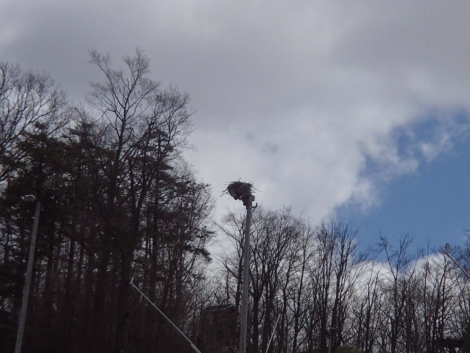
The trail continued along the bottom of the hill to the main Ski Chalet. As I had recalled from my time mountain biking at the hill, there was an Osprey nest on top of one of the light standards half way up the hill. Sure enough, the nest was still there and I was able to get a picture, from a distance, of the nest and a flying Osprey. The Osprey is a large raptor with a wingspan of as much as 70". It is one of only a few raptors that have 2 claws facing forward and 2 claws facing backwards that allows it to easily pick up prey like a slippery fish. It usually mates for life and grows to an age 10 years or more.
The Glen Eden Ski Area also has a museum and old farmhouse and barn including a 1830's log house.
The trail headed towards Appleby Line where it followed the road up and under Highway 401. It's at this point the Iroquois section of the Bruce Trail ends and the Toronto section starts. Yeh - another section complete!
The trail headed back in the bush north of Highway 401 and crossed another tributary of Sixteen Mile Creek cascading down from the Hilton Falls Conservation Area. The trail climbed back up onto the escarpment with nice shots of Kelso, Glen Eden and, once again, Toronto.
Finally, after some technical areas around and through the escarpment rocks, the trail ended at the Halton Country Inn Golf Course at the 2.5km mark of the Toronto section.
Another wonderful day of hiking!
Completed: 204.2km